
Map
1834Map Of The State Of New - York with parts of the adjacent Country Embracing Plans of the Cities, and some of the Villages; By David H. Burr, Geographer.
Map of the state of New York with parts of the adjacent country, featuring plans of cities and some villages, created by David H. Burr in 1834.
Closest kin

Map
Stony Point and Verplank's Point, New York, in 1779
Map
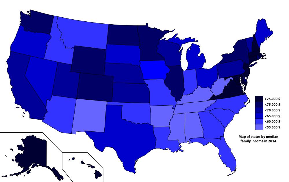
Map of states by median family income in 2014

Project
A history of New York in 50 objects courtesy of The New York Times

Project
Daniel Featherstone’s crisp images of the eccentric characters of New York

Project
New work on New York from awesome illustrator Josh Cochran